Retail & Recreation — BC
Hunt Smarter.
Find More.
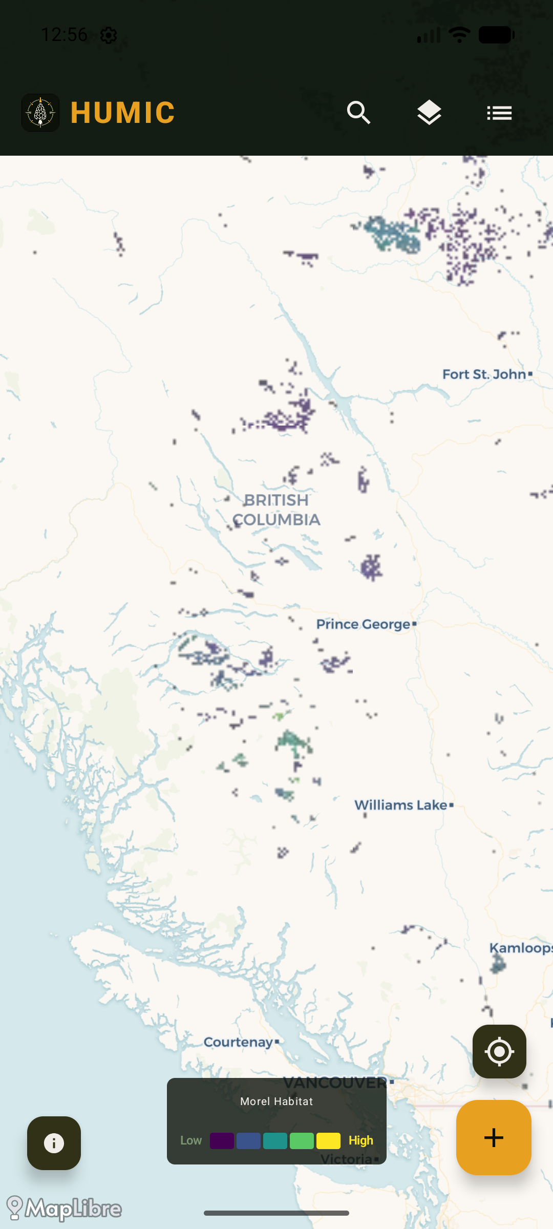
Mark your spots. Explore habitat potential layers. Know the terrain before you go.
Retail & Recreation — BC
Mark your spots. Explore habitat potential layers. Know the terrain before you go.
Every feature built for the conditions that matter — remote terrain, variable signal.
Pin your spots with GPS. Add a name, notes, and a photo. Tap any pin to jump straight back to that location on the map.
Parks & Protected Areas and Crown & Public Land overlays — free for all users. Know whether you're on public land before you go in.
A morel hunt-priority layer with BC Fire Boundaries (2022–2026) for post-burn flushes. Download map areas for full offline use in the field.
Core spot mapping is free. Upgrade for morel habitat layers, land context layers, and offline maps.
Free
$0
Always free
Pro
$10
per year — cancel anytime
Parks, protected areas, and crown land overlays — free for everyone. Toggle layers on and off to read the terrain before you go.
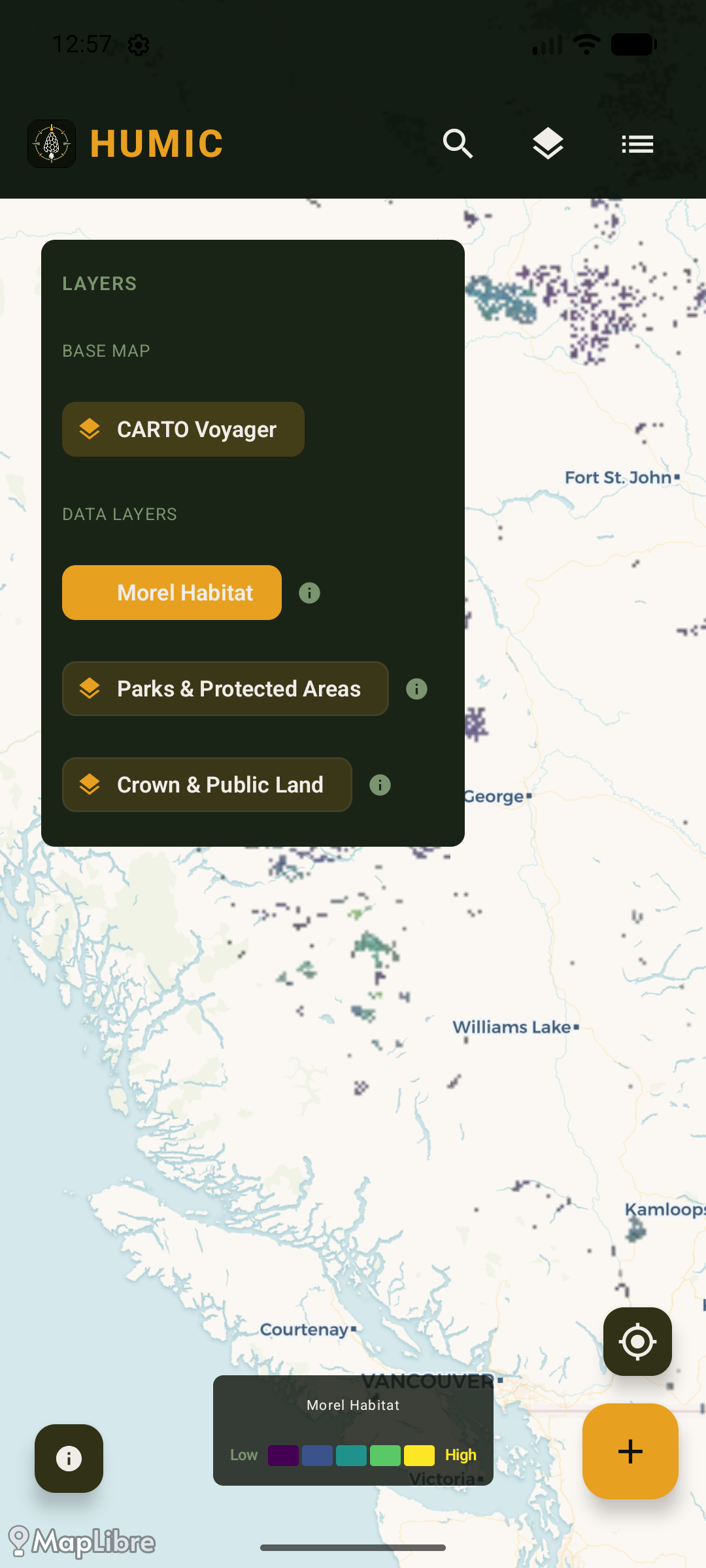
Three map layers, all in one place. Morel Habitat (Pro), Parks & Protected Areas, and Crown & Public Land — the last two free for everyone.